
The Annapurna Circuit Trekking Aleshventure: Up to the Tilicho Lake
October 1, 2019 .:. I MADE IT .:. I have completed the Annapurna Circuit Trekking Aleshventure. I have never hiked longer: 263 kilometres; 16 days and 15 nights in the mountains. I have never hiked higher: Thorung La pass – 5.416 m.
Three separate ascents:
Tilicho Tal (lake) @ 4.919 m
Thorung La (pass) @ 5.416 m
Ghorepani (village) @ 2.850 m
NO GUIDE: I just followed the signposting and used an electronic map.
NO PORTER: I carried my backpack all the way by myself.
NO ALTITUDE SICKNESS: Taking my time, resting, focusing on breathing and drinking plenty of liquids helped me to avoid it.
Two most memorable moments: reaching the Tilicho lake and Thorung La Pass.
While hiking, I saw some of the world’s highest peaks: Annapurna I, Annapurna II, Annapurna III, Annapurna South, Tilicho and Khangsar Kang.
So very grateful for having been able to do it.
Setting off
Living in tropical Thailand I came to Nepal ill-prepared for hiking in the Himalayas.
So, on the first day in Nepal, instead of exploring Kathmandu I went shopping. I especially needed shoes so I was super happy I’d bought a pair. I bought quite a few things and also rented a sleeping bag.
In addition, I needed to get two permits to be able to go trekking. One is the so-called TIMS (Trekkers’ Information Management System) card, and is a general permit for trekking in Nepal. The price is approximately 20 USD. Another permit is needed for a specific area a person intends to go trekking in. I was going to go trekking in Annapurna Conservation Area and so I needed an ACAP (Annapurna Conservation Area Project) permit, which cost about 30 USD.


Day 1
Bus ride: Kathmandu – Besishahar: 180 km .:. 7.5 hours .:. 400 rupees [+ 100 for luggage]
Being squeezed in a little seat of a crowded little bus, the last hour of the trip lasted too long. I was happy when I arrived.
Hike: Besishahar (760 m) – Bhulbule (840 m) – Ngadi (890 m): 11 km
Net hiking time: 2 hours and 30 minutes
I didn’t plan on hiking on the first day, but I ended up doing it as I still had time before it got dark. Also, I wanted to stretch my legs after the bus journey. When I started hiking the weather was fine but then it got worse. It went from drizzling to a downpour to drizzling to heavy rain. I got wet. My waterproof gear failed to keep me dry. At the end of the first day, I was anything but positive.
| Food price | Accommodation | ||||
| Breakfast | Lunch | Snack | Dinner | Price | Name |
| – | – | – | 1050 | 300 | Riverside Guesthouse & Hostel |
All prices are in rupees: 100 NPR is roughly 1 USD

Day 2
Hike: Ngadi (890 m) – Ghermu (1.130 m) – Jagad (1.300 m): 16 km
Net hiking time: 5 hours / A break of 1 hour 40 minutes
Cloudy, cool to warm. Rainy at noon. Drizzling in the afternoon. The views of the scenery were stunning. I loved the shades of green. I saw forests/ jungle, little villages/hamlets, rice terraces, waterfalls. Loved it. On the flipside, I didn’t like the trail. I hiked mostly along a dirt road some stretches used by jeeps and heavy trucks. The monsoon season not yet over, it was very muddy, difficult to hike at times.
| Food price | Accommodation | ||||
| Breakfast | Lunch | Snack | Dinner | Price | Name |
| 500 | 445 | – | 600 | 300 | Mont Blanc Hotel |


Day 3
Hike: Jagat (1.300 m) – Tal (1.700 m) – Dharapani (1.900 m) – Timang (2.635 m): 24 kilometers
Net hiking time: 7 hours and 15 minutes / 2 breaks totalling 2 hours 35 minutes
I hiked more than I had intended and so had quite a demanding day. Previous night, having hiked for 1.5 days, I had decided that the next village I’d stay at would be Dharapani.
I set off shortly after 7 am and reached Dharapani before 1 pm. I still had plenty of time, fairly good level of energy and so I decided to hike on. Although it was drizzling and later raining.
I also wanted to hike more to reach higher altitudes sooner desperately hoping for less rain and at least some sunshine. In addition, I had read that Timang was one of the most picturesque villages along the way so I had all the more reason to hike on. However, I would only be able to appreciate its beauty if it ever stopped raining. Those were my thoughts.
Hiking while it’s raining is never pleasant but what made me worried was when the trail I followed started to be in a really bad condition. Extremely muddy, not maintained and not signposted. My phone failed to load my GPS position and so I thought I might be lost so I turned around and continued hiking along the dirt road not sure at first if it led to Timang. Luckily it did. I was soaked and cold and happy to find the guesthouse I read about. There was hot water and to my great surprise there was a stove with fire in the common room. The first guesthouse to have fire. Super cool. So I was trying to dry my stuff along with a bunch of other guests who also had got wet.
One of the highlights of that day was that the sun came out. It only lasted for 5 minutes but I enjoyed every single second of it.
| Food price | Accommodation | ||||
| Breakfast | Lunch | Snack | Dinner | Price | Name |
| 450 | 580 | 385 | 590 | 200 | Tibet Lhasa Guesthouse |


Day 4
Timang (2.635 m) – Chame (2.650 m): 8 km
Net hiking time: 2 hours and 10 minutes
After a demanding previous day I took it easy, hiking slowly and doing just a short hike finishing at Chame where I had intended to stay since the beginning.
It had been raining all evening, all night and even in the morning. So I set off much later, at about 9.20. It was still drizzling, slowly fading as I was walking until I could barely feel or see the drops. Finally, it wasn’t raining anymore. I was so glad.
The hike was easy with some ascents and descents, the two villages being at about the same altitude.
| Food price | Accommodation | ||||
| Breakfast | Lunch | Snack | Dinner | Price | Name |
| 350 | 750 | – | 700 | 100 | Tilicho Guesthouse |


Day 5
Chame (2.650 m) – Bratang – Dhikur Pokhari – Upper Pisang (3.250 m): 15 km
Net hiking time: 3 hours 25 minutes / 2 breaks totalling 1 hour 5 minutes
What a great day! The weather was fantastic, the first sunny day since I came previous Saturday. Also, I got higher than 3.000 m, another milestone.
I got up at 6.30 and when I opened the door and looked outside I couldn’t have been more amazed. Crystal clear, blue sky and sunshine. I had never been happier about blue sky and sunshine.
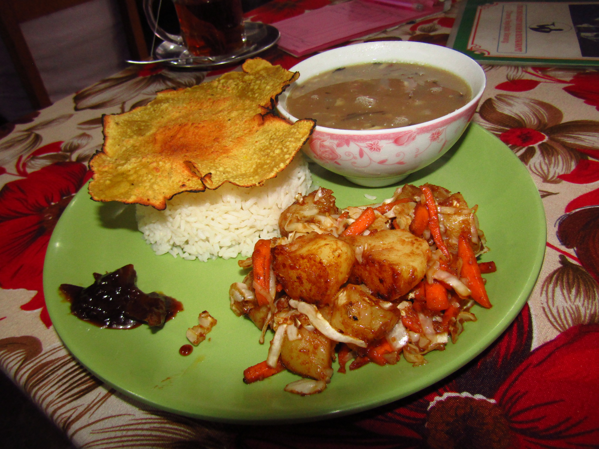
I took two breaks. I had a long 50 minute break in Bratang, sipping coffee and taking in the sunshine. There is an apple farm (imagine that!!! at 2.850 m asl) and so I bought a kilo of apples for 150 rupees (a dollar thirty). They were super delicious, really juicy.
Then I had a short break at the next village before finishing the hike at Upper Pisang. It was just 12.10 PM. I was thinking of going further knowing I had a very demanding day ahead but eventually stayed in a super nice guesthouse with the view of the peak Annapurna II (7.900 m asl).
Just one day of hiking left before reaching Manang where I’d spend a bit more time for acclimatization. It was going to be a long day.
| Food price | Accommodation | ||||
| Breakfast | Lunch | Snack | Dinner | Price | Name |
| 300 | 600 | 260 | 1200 | 200 | Hotel Norbulinka |


Day 6
Upper Pisang (3.300 m) – Ghyaru (3.700 m) – Ngawal – Braka – Manang (3.500 m): 21 kilometers
Net hiking time: 5 hours 10 minutes / 5 breaks totalling 2 hours 50 minutes
It was a demanding day. But a great day, too. Because I made it to Manang, the first major checkpoint on the trek. The following day was going to be a hiking free day, it was a day for acclimatization before I started a three day hike to the highest point on the trek, the Thorung Pedi pass at 5.416 m asl.
I had a very early start. I got up at 6 am, had breakfast at 6.20 and set off at 6.50.
The first part of the hike to the village of Ghyaru was really nice and easy. The second part was a 1.5 km long ascent to the village with a 400 m altitude difference. It was one of the toughest parts that day and of the trek thus far, too. At the top, there is a viewpoint offering stunning views of the valley and the mountains. I loved it and spent 40 minutes there.
The remaining sections of the day hike were fairly easy but hiking at an altitude of more than 3.500 m takes time. The next stop was at the Ngawal village, a really beautiful one, where I enjoyed and hour and a half long lunch break. The last 6 km were along the dirt road, not the kind of hiking trail I fancy and so I was happy to reach Manang shortly before 3 PM.
| Food price | Accommodation | ||||
| Breakfast | Lunch | Snack | Dinner | Price | Name |
| 400 | 1000 | 290 | 650 | 100 | Tilicho Hotel |


Day 7
Manang – Rest and acclimatization day
I woke up early despite not having plans to hike on. So I had breakfast and went to bed again. Felt so nice. There was a nice coffee shop at the hotel I was staying in so I had a cup of coffee and pastry. It was sooo good. And I’m not even a fan of eating pastry or bread. But once in a while it does feel nice to eat some.
I took a walk to Gangapurna lake but I didn’t find it all too impressive. I did a short loop over the lake to see it from above and have a closer look at the glacier but didn’t hike up to the viewpoint as I didn’t want to put too much strain on me. I wanted to see Annapurna III but the shy lady was hiding in clouds. Just like all the other peaks on that day.
I thought I would go and listen to the talk on altitude sickness prevention held every day at 3 pm in high season but they’d only start in October. There are a couple of places (projection halls) in town which show movies (Everest, 7 years in Tibet and the like) but they still seemed to be closed. So I was just spending the day eating, drinking and resting.
| Food price | Accommodation | ||||
| Breakfast | Lunch | Snack | Dinner | Price | Name |
| 435 | 570 | 590 | 495 | 100 | Tilicho Hotel |


Day 8
Manang (3.500 m) – Tilicho Lake Base Camp (4.150 m): 14.5 km
Net hiking time: 4 hours / 2 breaks totalling 1 hour
The original plan was to hike elsewhere. I only wanted to do the main circuit without any side trips.
But plans change. Two people, a local and a friend of mine, had told me Tilicho lake sitting at an altitide of 4.900 m was an absolute highlight of the trek. So on my rest day I had a dilemma: to go or not to go.
There were different factors influencing the decision such as time frame (I didn’t account time for side trips), weather, altitude, my physical condition and an additional challenge.
When I woke up I took a decision to go for it. Or at least give it a try. I felt really good and hoped it would last. The weather forecast was not favorable but to my great surprise the weather was really good while I was hiking. But the peaks were in clouds.
Some parts of the trail are potentially dangerous because of landslides and falling rocks. There are warning signs and as a general rule you shouldn’t stop while hiking along these sections to avoid injuries. The slopes with falling rocks were hundreds of meters long so it gave me an uneasy feeling. It’s better to hike along these sections in the morning while the weather is better and less likely to make the rocks fall.
A challenging day ahead. Fingers crossed.
| Food price | Accommodation | ||||
| Breakfast | Lunch | Snack | Dinner | Price | Name |
| 435 | 565 | 565 | 700 | 0 | Hotel New Tilicho Base Camp |


Day 9
Tilicho Base Camp (4.150 m) – Tilicho Lake (4.919 m) – Tilicho Base Camp – Shreekarka (4.075 m): 19.5 km
Net hiking time: 5 hours / Breaks totalling 2 hours 40minutes
Ascent: 2 hours 20 minutes [5.5 km] / A break of 1 hour 25 minutes at the top / Descent: 1 hour [5.5 km]
Hike to a viewpoint: 1.4 km/20 min one way
Tilicho Lake is thought to be a highlight of the trek. And highlight it was.
It was one of the more demanding days. I set off at 6.15. The weather wasn’t very good at the beginning. It was foggy and cloudy. But when I reached the lake I was rewarded with fantastic weather. I was ecstatic. It was sheer joy to see the stunning lake, a feeling accentuated by great weather. I loved it and consider it one of the most beautiful places I have been to. I could see some snowy peaks and even avalanches. I hiked to a viewpoint on the side opposite the mountains where the altitude was about 5.000 m asl.
I hiked down fast and after lunch continued to Shreekarka to get closer to the main circuit.
| Food price | Accommodation | ||||
| Breakfast | Lunch | Snack | Dinner | Price | Name |
| 495 | 550 | 455 | 950 | 200 | Himalayan Guesthouse |


October 1, 2019 .:. I MADE IT .:. To continue reading about my adventure click here: THE ANNAPURNA CIRCUIT TREKKING ALESHVENTURE: OVER THE THORUNG LA PASS.